Tuesday, April 15, 2014

Home Stretch


It's time for our last run for home. We've taken our time just to make sure all that nasty winter stuff is long gone before we get home. A lunch break on our drive to our next stop, Lexington Kentucky. What a warm sunny day.
 After Lexington, our next stop is Flatwoods, West Virginia. Only one day here, we're running out of time. This spot was in a bowl surrounded by hills. Very quiet, we couldn't hear any traffic from the interstate just over the hill. They must put on some big concerts; the stadium behind us could seat thousands and had a very large stage.
Our last stop before home is in Chautaugua New York. It's a lovely RV Resort with a beautiful lake and lots of hiking trails.
We planned on spending a free day here just taking it easy
  but the first weather report called for up to 5 inches of snow overnight. This is hilly country and I don't want to be slipping trying to get up or down a hill, so we packed up everything and was pulling out within the hour. We're getting pretty efficient. Very strong winds and heavy rains gave us a driving challenge as we headed home, but no real issues. The border crossing went well, thank goodness!
We got to connect with the grandkids a day early and relax. The weather is wild so all I did was park and hook up the electrical. Other hookups can wait till tomorrow.
Woke up to this! In 6 years of travel, this is the first time we got home to a winter storm. Guess I won't be hooking up water and sewer for another day or two. It's supposed to set a record low tonight before temps start to moderate. Another week down south would have been a good idea but who knew. But it beats trying to drive in this so I'm glad we came home early. Well, that's our trip home. We'll be back in the fall, God willing.

Wednesday, April 9, 2014

The Last Trace

Well, we've done this section of the Trace up right so it's time to move along. A stop along the Tennessee River gives us a chance to stretch our legs.
Our next stop is a rustic campground about 80 miles south of Nashville. We had the place to ourselves. Quiet but cold.
Just south of our campground is a stretch of the original Trace we can drive on, now we're cooking.
The original Trace generally followed ridges to avoid swamps, like this. Ridges aren't too straight and this trail took a lot of twists and up and downs. That's why it took up to 10 weeks to get home.
This was once a phosphate mine. The original mine caved in and the train tracks have been removed. Not that a train came here; a donkey engine moved the mineral by rail to the Trace so wagons could take it to market.
There are lots of waterfalls along this stretch. It's gentle now but I'm not sure this would be a good place to stand after a major rainfall. We kept our eyes on the sky!
History lesson. If you haven't heard of Lewis and Clark, you better Google it. Meriwether Lewis was born into money and after spending time in the military and as President Jeffersons personal secretary, the president asked him to explore the land west of the Mississippi. He and William Clark were tasked with finding a water route to the Pacific Ocean. Although they didn't find a water route, they went nearly 8000 miles to the coast and back. At 34 he was rewarded for his service by being made Governor of the Upper Louisiana Territory. On a trip back to Washington the next year to explain his expenses to the new President, at a stop along the Trace called Grinder's Stand, alone in his room, shots were heard and he was found fatally shot. Suicide was the verdict. I didn't know how he died. He was buried at this spot along the Trace.
This house was built in 1818 for the owner of a trading post and ferry. It's one of the few buildings left from that time but what's really cool is the vulture family on the right chimney. We spotted both parents and at least 4 baby vultures. Vulturettes? Maybe you can zoom in a bit.
Another waterfall. The shale terrain makes for some lovely falls and scenery.
Our timing is great for viewing spring colours. The Red Bud trees were everywhere and made for a pretty drive. As well as dogwood and Bradford pear trees.
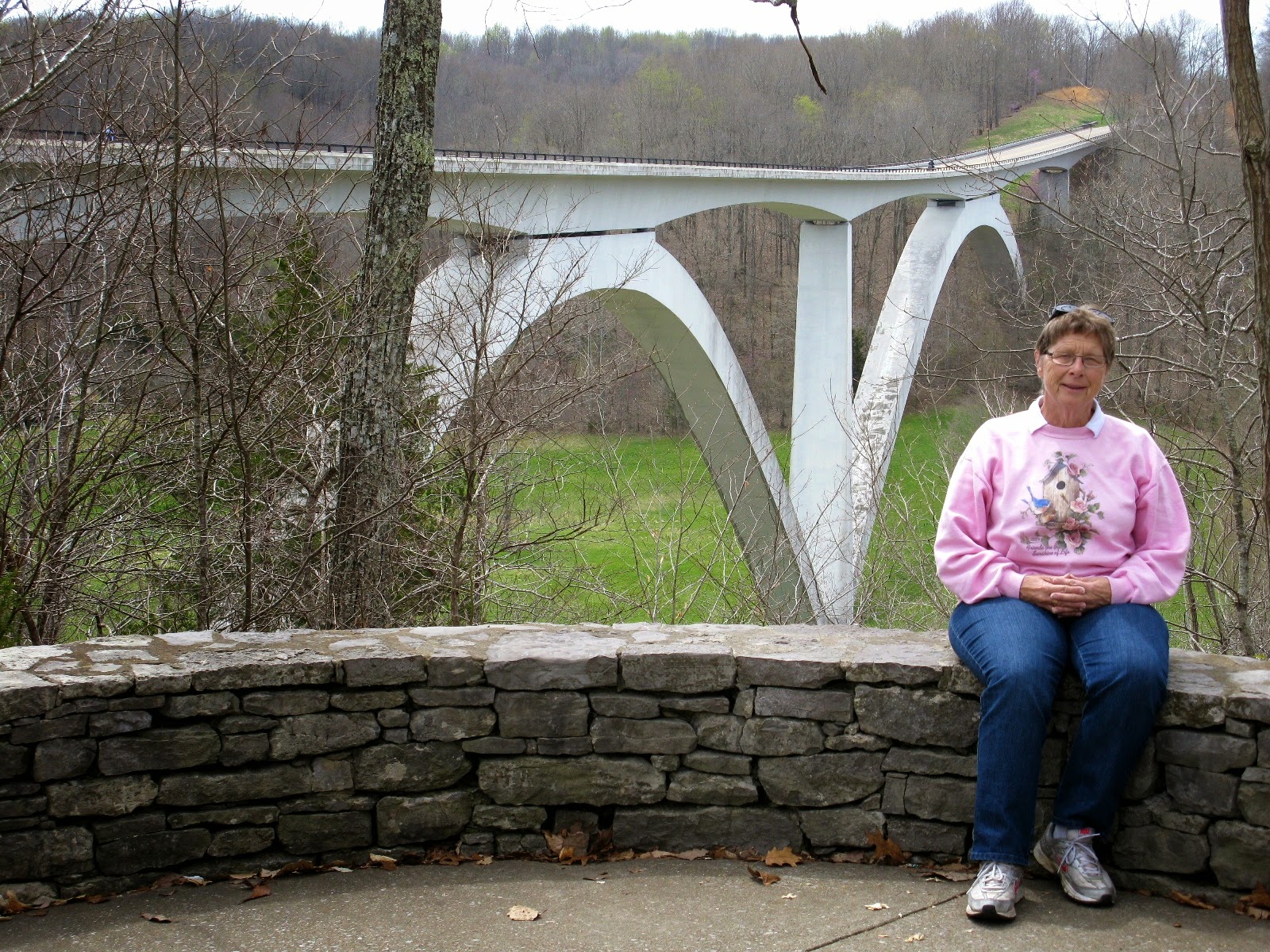
Near the northern terminus is the final addition to the new Trace road. This bridge at Birdsong Hollow won an award for design when it was completed in 1995.
This is the northern terminus. We have travelled the whole Trace from one end to the other, usually multiple times. We figured that on the 444 mile Trace we actually drove over 1200 miles. How you say? Well, we drove and parked. Then we drove the Jeep up the Trace to see the sights and then we came back to our campground, then we drove the RV to the next stop and repeated. That meant at least 3 times past each spot. Now that's doing it up right wouldn't you say. Enjoyed every minute too!
We even managed to see some sights off the Trace along the way. This is the downtown core of Columbia Tennessee. We visited a few shops and had a great lunch.
Our GPS gave us a couple of options when we finally had to leave the Trace. We decided that this wasn't one of them. I'm glad we did a bit of exploring before traveling the backroads. As a result, we took a bit safer route to our next stop on our way home. We've left the Trace; we've enjoyed the route and miss it.
Well, it's time to get serious about getting home. No more procrastinating. But a couple of days outside of Knoxville Tennessee wouldn't hurt. After all, there may still be snow back home.


Friday, April 4, 2014

Natchez Trace 3 or The King and Eye

We've left Jackson behind and travelled 190 miles to Tupelo, Mississippi. The RV Resort is quite quaint, this is the office/storm shelter. Not too sure about this.
As we checked in, the manager told us that the weather is looking nasty for tomorrow night; possible tornados. Oh great! The resort is built on a hill and because I expressed concerns, he made sure to put us on the highest site in the park, no kidding.
This is the bottom, that's the top. Anyway, that's not till tomorrow night.
After a good nights sleep, we're off to check out more of the Trace. Although the Trace was not used much by the time of the civil war, a lot of battles happened and a lot of armies travelled along it. These are Confederate grave stones along the Trace. 
Good forest husbandry requires occasional burns to keep the area clear of fire hazards and promote new growth. The Trace didn't need burning I guess.
We try to learn about things in the areas we travel. For example what does a dogwood tree look like? You can tell by it's bark; get it? Anyhoo, I can now identify what it looks like. It looks like I'm afraid of its bite as well.
Remember the storm in Vidalia? Apparently it got to here as well. Lots of trees down along the road.
There are dozens of Indian mounds along the Trace. Used as burial and ceremonial sites, some are from 1 AD to 1000 AD, now that's old.
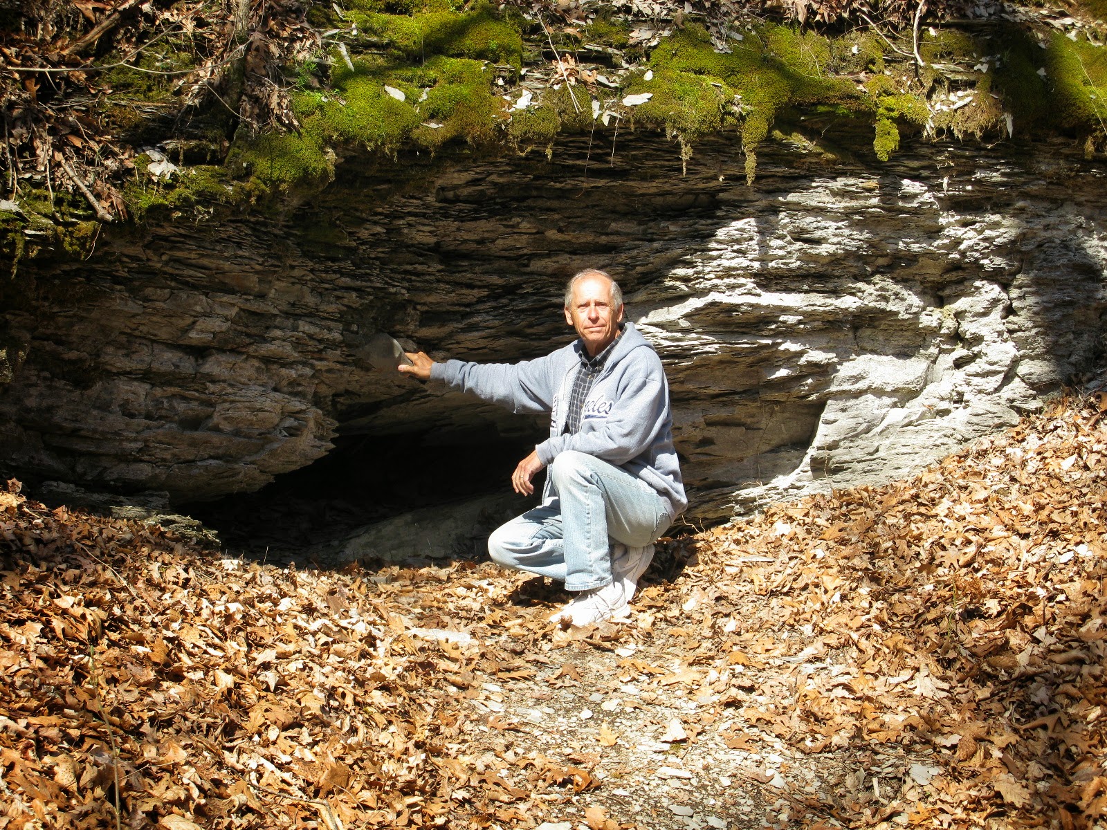
This is Cave Springs where the local Chickasaw Indians spent their weekends spelunking and barbecuing, I guess. A great spot to avoid bad weather.
I found a wood nymph at Buzzard Roost Springs, a wayside station along the Trace.
Just up the road is the crossing at the Tennessee River. Back in the Trace days, there was a ferry here to take the travelers across. When the Confederate Army needed to cross, the operator charged them $75,000 to ferry them across. Now there's a smart business man. I'm surprised they didn't shoot him. 
A babbling brook and underground spring keeps this creek at 57F and running year round. Very soothing. It went downhill from here. Remember that cute RV Resort office/shelter? Well, the tornado siren went off at 3:30 AM so we grabbed our emergency bag of stuff and headed down to the shelter. Do you remember the 3 pigs? If our RV is the straw house, then the Shelter must be the twig house and didn't feel too safe if the big bad wolf came huffing and puffing. Fortunately the bad weather passed us by and we got back to bed about 5 AM.  The Eye missed us!
Not to be put off by near disaster, and being in Tupelo, we must go to see where the life of the King started. So after sleeping in a bit after our night of terror, we headed over to the birthplace of Elvis. This is where he was born, in a shotgun shack built by his dad, uncle and grandfather. Shotgun shacks were built so that the front door, a hall way, and the back door were all aligned so that a shotgun fired through the front door would go out the back. I'm not sure why that was important.
The shack where Elvis grew up had 2 rooms. This is the kitchen and dining room. The shotgun pellets would pass to Grammies left.
This is the other room, both living and bed room. The pellets would also pass to my left. That's it, the whole home. Although Grammie says it's still bigger than our RV.
But we do have an indoor privy!
The church where Elvis went as a child was going to be demolished to make room for a bigger church so it was moved onto land beside his boyhood home.
It was here that he was exposed to hymns and the music that would shape his future. 
On the museum grounds is a statue of Elvis at 13, the year that he and his family moved to Memphis. By then he had started singing in public and better opportunities were coming in Memphis.
When he was 11, his mom took him to this hardware store to buy his birthday gift. He wanted a .22 gun but his mom was scared about it so the store clerk showed him a guitar which he and Elvis' mom convinced him to take instead. Just think, he might have become a world class sniper instead!
After our museum visit, which honestly, got us thinking about Elvis, his career, and how we enjoyed his music, we stopped at a local drive inn for lunch. Called Johnnies, it was a spot where Elvis hung out. We didn't know that until we found ourselves sitting in Elvis' booth. The picture above us shows the King sitting in the same booth and the same spot as I am. What a cool connection. Well, now they're calling for severe weather again tonight. Hopefully we'll be blogging again soon. TTFN


Wednesday, April 2, 2014

Natchez Trace, Part 2


 We've left Natchez and travelled along the Trace to Jackson Mississippi. About 90 miles. Now it's time to explore the Trace north of Jackson. The original Trace was a walking path which was changed to a road as explained on the sign.
Sections of it are being kept up to prevent the trees and bush from growing back in, but it is the original Trace and the original size.
It looks perfect for the Jeep. Bet we could have done it in under 30 days.
This is one of the towns that sprung up along the Trace. Although the buildings are authentic to the era, most have been moved here to create a pioneer town. 
One of the original inns is still serving food so we went back in time.
I'm not sure they used to serve ice cream and I bet it wasn't using styrofoam and plastic. There are lots of information spots along the Trace but very few things to see or do so we're enjoying the novelty.
Just north of Jackson is a giant reservoir caused by damming the Pearl River. Those wild animals in the fore ground seem to be enjoying the spot. Although thousands of acres were flooded, the Trace survived because it usually followed ridges to avoid swamps and wetlands. How fortuitous.
Speaking of Jackson MS, as everyone knows, that's the capital of Mississippi and as you all know, Grammie and I like to check out capitol buildings. Which brings up an interesting fact. Notice how I spelled capital two different ways? If it's spelled with an A it's the town or city which is the states capital. If it's spelled with an O it's the actual legislative building. Bet you didn't know that!
The building in the last photo is the old capitol building. It was opened in 1839 and is the location where the first legislation in the US allowed women to own property and where Mississippi voted to secede from the union, starting the action that resulted in the civil war.
As you probably know, we like to take dome photos so this is from the old capitol building.
 
This is the current capitol building. It was built in 1903 for just over 1 million dollars. Hard to believe isn't it.
This is the dome of the current capitol. Much more spectacular isn't it.
This is the main foyer. State capitols are so impressive. I don't think they could build one like this today. Not only the expense, but a lack of skilled tradesmen.
Even the stairs are marble. Doesn't Grammie look like a southern belle descending the grand staircase?
Time to leave Jackson and head towards our next stop along the Natchez Chase. Our usual pit stop. Damn that coffee.
It's a beautiful drive through the quiet countryside. How idyllic. it's 160 miles to our next stop along roads like this. No traffic; that's how driving should be.
Then we came across a sign saying that the next 10 miles of damage was caused by a tornado in April 2011. Oh yeah, tornado alley, we forgot. How does a tornado do this for 10 miles. I thought they lifted once in awhile. Apparently this particular tornado stayed on the ground for 240 miles and killed over 15 people.
Here's where the tornado veered off the road. The trees coming up look untouched; how arbitrary. Oh, by the way, the radio just announced a chance of tornadoes tonight. If this doesn't scare the crap out of you I guess you're just reading this, not typing it. If you don't get another post from us, well you know what happened. Otherwise TTFN.