Friday, November 15, 2013

Well, we made it.

 
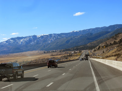
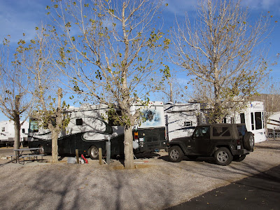
Well, we made it. We got here a few days early because we had to hightail it out of Yellowstone. Beautiful sunny day and about 85F. We got here around 11AM so lots of time to set up and start organizing. 
Two days later and we're just about finished. Window shades, tire covers and awnings make sure we control the sun; it's been around 90F since we arrived. Now we're ready to start enjoying the activities. I've already gone golfing (didn't do too bad for the first time) and enjoyed a Hamburger Bash, so we're jumping right in.
A quick review of our trip south would seem to be the best way to wrap up our adventure this fall. First day of the trip with a major breakdown. Is this a sign of things to come? Who knew at this point.
Fixed and back on schedule. Next adventure was our Agawa Canyon train trip. A nice relaxing day; I didn't have to drive, bonus. 
First stop in the US. This was the only RV resort to date that we got turned into the park and couldn't make the turn. We had to unhook the Jeep so I could back up and make the turn. Didn't like it. 
Worlds only corn palace was next. We do see the sights, don't we. 
Wall Drugs in South Dakota is just too cool to miss.
Remnants of the big snow storm at Rapid City. Not really a highlight is it.
Another chance to see Mount Rushmore from Custer State Park. A great drive! 
We got to stay in a pioneer military fort at Casper Wyoming. 
Cleared the Continental Divide before heading down hill toward Yellowstone Park.
Saw Old Faithful in Yellowstone. 
Also saw hundreds of geysers and buffalo. Yellowstone was worth the drive.
City of Rocks in Idaho was unique. 
The drive into Nevada was awe inspiring.
Exploring the area around the Ponderosa Ranch was a lot of fun. 
From Virginia City 
To Reno 
To Lake Tahoe
Lastly, our trip to Yosemite Park was highlighted by the drive to get there. 
A great drive and the scenery was awesome. We went from here to another stop and on to Hemet. That's a quick review of our trip, not a bad drive I think. I'll bet you're wishing I had done this before and saved reading all those blog postings, huh. Well, we're all settled in so any blog postings from here on may be few and infrequent. But check once in awhile just in case we do something interesting. Keep safe.


Thursday, November 7, 2013

Yosemite

 
Time to leave the Ponderosa and head south. We need to go through numerous mountain passes to get to our next stop. They start at 7700' and go up to 9900' before we start working our way down. 
Because they hug the mountains, there are a lot of switchbacks and hairpin turns as we rocket to sure doom.
Sheer luck and incredible driving get us through. Now we have time to enjoy the grandeur of the majestic peaks. The respite from the driving gives me a chance to massage my braking foot. 
Anyhoo, we arrived in Bishop CA safely and got settled in. It's noticeably warmer here; have we finally escaped the freezing nights? 
The main reason we went this way was to go see Yosemite Park. Actually, our mascot, Yosemite Sam has been bugging us for years to go see his home, so here we go. Why do all our trips start with impenetrable mountain walls?

Well, this is the way through. This is Tioga Pass which gets us to Yosemite Park. If you can see the narrow scar on the left side, that's our route. 11 miles long and over 9800' high. Glad we're driving the jeep. 
At the top of the pass we can see part of Yosemite Valley, our goal today. That bump in the middle is half dome, a famous feature in Yosemite. Another couple of hours to get there though. 
This is the kind of scenery we drove through all day. You should see the pictures I'm not showing.
Once we arrived at the valley, the drive was relaxing and beautiful. What a great area to explore. 
This rock is called El Capitan. Once considered unclimbable. Thousands of feet of sheer granite, as smooth as glass. One of the major features of Yosemite. Which reminds me, when you think of Yosemite, what comes to mind as a must see there? That's what we came up with. Couldn't think of anything either. We had heard of El Capitan so here it is. It's an incredible park for awesome vistas but nothing that is a must see, like Old Faithful in Yellowstone; at least nothing we could think of.
One thing we have learned with all our park visits is that nothings open this time of year. Grammie is getting our lunch ready while I plan the rest of the day. The food does taste good at this altitude amongst the whispering trees and smell of  pine. 
The drive through the valley is lovely. It's a warm day with lots of sun and lovely colours, surrounded on all sides by vertical cliffs and waterfalls. Well, except that water levels are low and there aren't any waterfalls right now. Some are over 500' high; just use your imagination. 
The drive out of the canyon hugs the cliffs and goes through tunnels. In most cases there aren't any guard rails so PAY ATTENTION! 
Back up through the high passes. This road just opened 2 days ago after being closed for snow. Glad we made it through. 
There are lots of roadside stops and we hit most of them. Grammie's not getting too close to the cliff to her right. And she's bracing against the high winds coming down the pass. 
A lot of the park is made up of these granite hills. Very impressive. 
The lakes are awesome but I'll bet they're cold. It's 9000' and most of the water comes from melting snow. 
We stopped here for a snack break but sat in the Jeep. Cold and a very strong icy wind.
Here's the final pass we need to get through to get out of the park. Our route hugs the far left hills. This pass was built in 1910 for $62,000. It's 11 miles long and rises 8000' to over 9800', or as in our case, falls 8000'. Yosemite Sam told us it's just like he remembered. Well, we've been to all the parks on our list for this fall so I guess it's time for our final run to Hemet. Hope you've enjoyed the tours along the way. Maybe one more post about this trip. I know, is that a promise or a threat?


Tuesday, November 5, 2013

Do You Remember Bonanza

 
If you've been around as long as us I'm sure you'll remember the TV show, Bonanza. Each show started with this map which then started burning. We saw it dozens of times but until we came here I never realized it was in this part of Nevada. Virginia City was the key city with Reno and Carson City never mentioned. 
That must have hurt Reno's feelings because this is their famous sign. Nyah, nyah, Virginia City. We went for a drive through Reno, but other than casinos, there wasn't much to take a picture of. We saw lots of taxis with signs advertising the Mustang Ranch but we couldn't get a picture. Not that I really care about horses anyway. 
Leaving Reno we're heading for Virginia City. To get there we need to go over a mountain pass with lots of switchbacks. 
I'm glad I'm driving the Jeep. I don't think Harvey would fit some of the corners. That's Reno in the far background. 
Virginia City is a Federal landmark and nearly all the buildings on the main street are original for the 1860's.
In its heyday, Virginia City was taking so much gold and silver out of the ground that they were billing themselves as the "richest place on earth". In today's dollars, they pulled billions in wealth from the ground. This is where the Comstock lode was located; considered the richest gold find ever found.
Wherever that much money is found, gamblers and other shysters could be found. This gambling table is called "the suicide table". 3 people, after losing everything at this table, committed suicide. After that, no one would play at the table so it was put in storage until it was found in 1990. Still, no one will play on it. 
This mine is right in the middle of town. It didn't seem to matter where someone sunk a shaft, they'd hit gold or silver. Due to a problem with the mine tailings, no more mines could be dug in the town limits.  
Mining is still going on although the yields are somewhat less than before. At the peak, over 25,000 people lived here and with the fortune that was removed from here, it was the richest mining town ever built. 
To make sure we cover the total Bonanza experience, we're moving our base of operations to Carson City, the northern edge of the Ponderosa ranch. By the By, according to the map, the mountains ahead are part of the ranch. That's one big property Ben Cartwright has! 
Carson City is the capital of Nevada and as you know by now, we're Capital junkies. This is the state capital, the second oldest Capital building west of the Mississippi. 
Grammie and I and Sarah Winnemucca pose in the Capital rotunda. She was quite gracious, if a bit stand offish. Kinda reminded me of C3P0. 
We walked through the old part of town to get a flavour of what Carson City was about. Apparently it's about gambling.
We walked the Kit Carson trail which is a walk through the historic part of Carson City. Dozens of 1900 era homes are preserved in excellent condition but we're not going to bore you with a bunch of unique old buildings, save this one. John Wayne's (my hero,s) last movie was the Shootist. This home was featured in the movie as his last residence. Now that's historically significant!
To complete the total coverage of the Bonanza empire we need to see Lake Tahoe. There is a scenic drive around the lake that is billed as the prettiest drive in America. We'll see, after all, we've seen a lot of scenic drives in our travels. Dozens of small towns surround the lake. This is South Lake Tahoe on Route 50 ( by the way, Route 50 is billed as the loneliest road in the US; it's the original Pony Express trail). Half the lake is in Nevada and half is in California. How do you tell the difference? No casinos in California. 
When the road isn't going through a town, it's going through wilderness areas. All kinds of  trees, mountains and lake views. Due to its altitude, high mountains and such a large lake, it's billed as the largest ski area in the US. It's also a year round vacation area, from swimming, fishing, hiking and skiing. Properties are valuable and some are spectacular. It's hard to believe some of the homes are just getaways.
We must have take a dozen lake pictures; they were all as lovely as this. Lake Tahoe is 6225' above sea level and is 191.6 square miles. At 1645' deep it's the second deepest lake in the US. 
This is Emerald Bay, considered the most photographed spot on the lake; and who are we to argue. This is on the west side of the lake so none of Ben Cartwright's cattle pooped here. Bonus. After driving the whole lake in about 5 hours, we feel inclined to agree that it's as lovely a drive as we've seen yet.  
We've covered as much of the Ponderosa as possible and are impressed with its size, although honestly, the land covered by the ranch is so poor they needed a lot of ground to feed all those cattle. We're back at our RV Resort in Carson City getting ready to head on to our next adventure. Boy, it just keeps getting better! TTFN